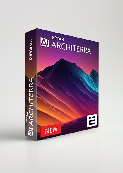
home > Architerra 5
FULL version:
1143 €

  Buy FULL version

All price includes VAT!


Warning: filemtime(): stat failed for ./cad_download/ArchiTerraPlus-5.0.1.53-windows-2024-10-30.exe in /var/www/test-eptar/web/cad_content/product_overview.php on line 592
January 01. 1970.DOWNLOAD WIN - INT, GER, ITA

Warning: filemtime(): stat failed for ./cad_download/ArchiTerraPlus-5.0.1.80-AC23-AC28-INT-mac-2024-12-04.dmg in /var/www/test-eptar/web/cad_content/product_overview.php on line 592
January 01. 1970.DOWNLOAD MAC - INT

Warning: filemtime(): stat failed for ./cad_download/ArchiTerraPlus-5.0.1.53-AC23-AC28-GER-mac-2024-10-30.dmg in /var/www/test-eptar/web/cad_content/product_overview.php on line 592
January 01. 1970.DOWNLOAD MAC - GER

Warning: filemtime(): stat failed for ./cad_download/ArchiTerraPlus-5.0.1.53-AC23-AC28-ITA-mac-2024-10-30.dmg in /var/www/test-eptar/web/cad_content/product_overview.php on line 592
January 01. 1970.DOWNLOAD MAC - ITA

Architerra 5

English - German - Italian   |   ARCHICAD 23-24-25-26-27-28   |   WIN - MAC


Architerra is the solution for ArchiCAD users to create and manage 3D terrain models. It is a useful tool especially if you need to work with large sites, allowing the insertion of other elements such as roads, plateaus, buildings and others.

Architerra was developed and created to solve a particular problem for ArchiCAD users: the creation and management of tridimensional land models.

Architerra helps to create solutions for terrains by drawing your own site or importing data from different types of files, like DXF, Text or Shape files and allows you to work and visualize the morphology in 2D and 3D.

New in Architerra 5:
  • Archicad 23-28 support
  • Display slope areas on floor plans with color indicators for better visualization
  • Improved road handling with route line associativity, ensuring the route line remains connected to the road
  • Ability to create new breakpoints along the placed road
  • Smoother breakpoint rounding, similar to polyline handling
  • Option to delete segments between breakpoints
  • Automatic road updates after any adjustments along the route line
  • Offset function to adjust road placement based on the route line offset
  • Road surface fill options for customizable road appearance
  • Junction: New tool for placing road junctions and roundabouts
  • Manual placement via a reference point
  • Automatic placement at road intersections or route lines
  • Manual junction editing for improved visual alignment
  • Automatic road section updates, removing the need for manual refresh
  • Enhanced Archicad-style icons with higher resolution for clearer visuals
  • New listing format to efficiently summarize required earthwork


Main Features:
  • Railway
  • Railway crossing
  • Railway bridge option in the existing bridge tool
  • Bridge tool: the possibility to place bridges and overpasses
  • Redesigned road: expanded with curbs and bisecting lines
  • License borrowing: get for limited time (7 days) the activation key offline. After this time period the key become online again. This option is but permanent, and you can use it at any time. It can be ordered for your existing license, too.
  • Color Slopes of the morphology and contour lines in 2D and 3D
  • Management of the terrain using polyline or fill
  • Creation of plateaus, roads, sidewalks and cross sections with the earthmoving icon
  • Insertion of street furniture such as trees, buildings and other elements
  • Insertion of the heights and objects
  • Creation of a more lifelike environment for the project
  • The camera tool allows you to walk in the terrain
  • Controlling the project's environmental impact while still in the planning stage
  • Export in Text (txt) file


Supported versions:
  • ARCHICAD 28
  • ARCHICAD 27
  • ARCHICAD 26
  • ARCHICAD 25
  • ARCHICAD 24
  • ARCHICAD 23


Supported operating systems
ÉPTÁR's solutions have been tested on the Windows 10, macOS 10.15 Catalina and macOS 12 Big Sur operating systems, we can guarantee their operation under these conditions.
We cannot provide technical support when using other software versions or operating systems! Thank you for your understanding!


Buyers from Norway are provided a special version Architerra with SOSI import. Please, contact our Norwegian reseller for extra function, SOSI import Architerra licenses.


Online Key registration


ARCHITERRA - FREQUENTLY ASKED QUESTIONS


Q: How can I buy Architerra?
A: There are two ways to purchase your Architerra license. You can purchase it online through the BIM Shop online at PayPal or at your local reseller.

BIM Shop: You can purchase from the product page. If you would like to request an invoice, please send us your invoice details (Name / Company name / Address / Tax number) to info@eptar.hu and we will send you an invoice in reply. After paying the invoice, we will activate your license, which you will also receive in electronical form.

Via Resellers: You can find a list of our resellers on our website. If you do not have a reseller in your country, please use the BIM Shop or contact us by email!

Q: How can I install Architerra on my computer?
A: To install Architerra go to: https://www.eptar.hu/ArchiTerra and press DOWNLOAD considering whether you work on Windows or Mac. Close ARCHICAD and follow the instructions given by the installer. After starting ARCHICAD, the ÉPTÁR Solutions menu appears in the program’s menu bar, which you can open to access Architerra.

Q: Do I have to register in Éptár webpage to be able to buy Architerra?
A: Yes, a registration is necessary for the activation of the solution. After registration and login you can give your data and also select the type of key (online or machine) and set it.
You can give your Architerra username and password here for online key that you can use to start Architerra on your device.

Q: How can I set up the online key?
A: In case of an online key, an optional username and password must be entered. After installing and starting ARCHICAD, you must select "Architerra Registration", then pressing "Validation" and "Online validation" buttons. You have to enter the username and password you have given after logging in to eptar.hu then activate Architerra by pressing the "Activate" button.

Q: What shall I do if I want to use Architerra on several computers at a time?
A: If you want to use Architerra on multiple machines at the same time, you will need as many licenses as many machines you want to use on at the same time. An Architerra license can run on only one machine at a time. Multiple licenses can be purchased with the same key data.

Didn’t find an answer to your question? If not plase contact us on this address:
E-mail: info@eptar.hu
All price includes VAT!
PARTNERS   
a-null.com
www.applicadthai.com   www.dcs.co.th
architechnologies.com   www.vector-data.ph
wsc.pl   www.argasprojekt.pl   multibim.pl
www.hicad.rs
cadexpert.sk
www.modistudio.hu    www.pircad.hu
www.dimensionplus.in
www.piranusa.com
www.fermatdesign.it
archia.lv
www.infor.pt
https://www.nordicbim.com
www.bimticino.ch
www.topsw.gr
www.3dart.hr
graphisoft-nord.de   inside-systeme.de
www.pilon.si
designsolutions.lt
greends.com.vn
archicadecuador.com
www.licentesoft.ro
https://www.facebook.com/graphisoft.ukraine/

a-null.com    www.applicadthai.com    architechnologies.com    wsc.pl    www.argasprojekt.pl    www.hicad.rs    www.modistudio.hu    www.piranusa.com    www.pircad.hu    cadexpert.sk    www.dcs.co.th       multibim.pl    https://www.nordicbim.com    www.dimensionplus.in    www.pircad.hu    www.infor.pt    www.bimticino.ch    www.vector-data.ph    www.topsw.gr    www.3dart.hr    graphisoft-nord.de    www.pilon.si    https://www.facebook.com/graphisoft.ukraine/    inside-systeme.de    designsolutions.lt    greends.com.vn    archicadecuador.com    www.licentesoft.ro    www.fermatdesign.it
Are you interested in becoming an Eptar Partner?

Apply now
    Like all websites, eptar.hu uses cookies for better and safer operation.       More information